

600€
Route
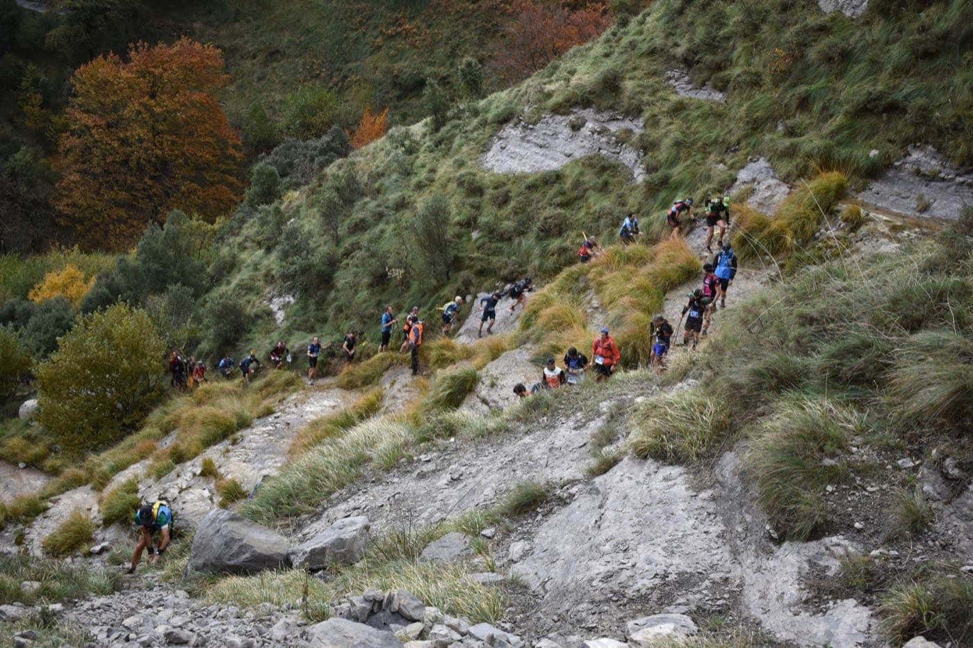
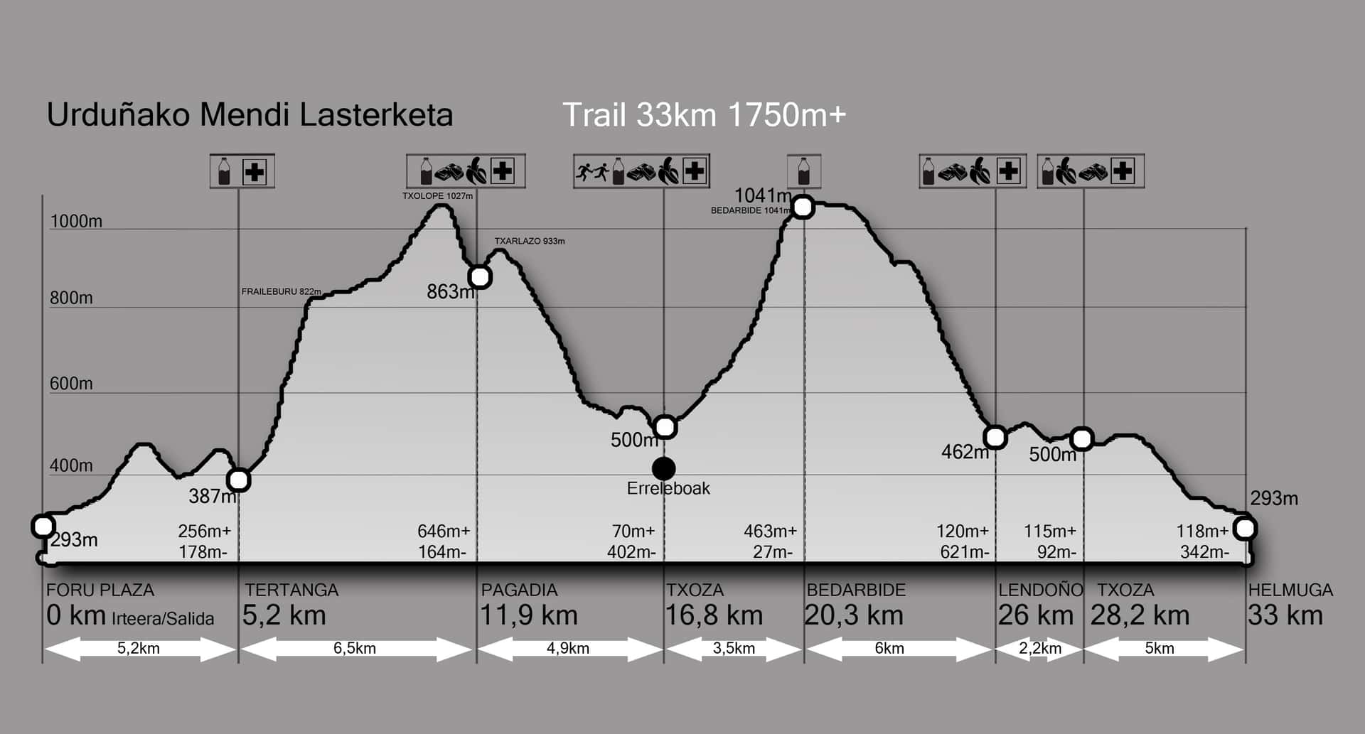
The main race covers 33km with 1,750m+ of elevation gain, starting and finishing at Foru Plaza in Orduña. From the old town, the route heads towards Tertanga, crossing rivers and passing under the emblematic Pico del Fraile, a huge boulder shaped like a friar.
After the climb, we ascend to Mount Txolope (1,026m) with panoramic views of the valley and the Virgin of Txarlazo. We descend along the ancient road that connected Castilla with Bizkaia, passing by the Gualdetxu spring, to the Txoza recreational area, which marks the halfway point.
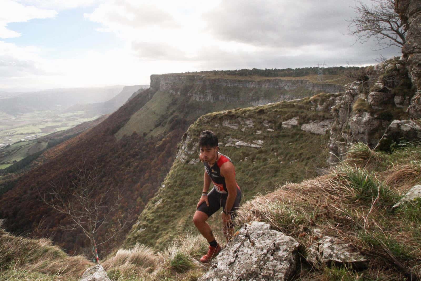
The second half takes us through the spectacular Bedarbide climb between rivers and waterfalls, traversing the heights of Sierra Salvada to La Ponata and the famous Senda Negra, with its impressive cliffs and stone walls.
The final section descends through a beech forest to Lendoño de Arriba before returning to Orduña through the Valley of the Kites, with panoramic views over the entire mountain range. A route you won't forget.
Elevation profile
1.041m
293m
1.750m+
1.750m-
Trail 33km prizes
The individual race gets its own spotlight with cash prizes for the top five overall finishers.
300€
150€
100€
75€
Race records
2h 46min 16seg
Imanol Goñi
3h 24min
Ainara Urrutia
Route highlights
km 0
Foru Plaza
293mStart from the old town of Orduña
293m
Foru Plaza
Start from the old town of Orduña
km 0
km 8
Fraileburu
822mHuge boulder you must pass under
km 8
Fraileburu
822mHuge boulder you must pass under
km 10
Monte Txolope
1.027mPanoramic view of the valley and the Virgin of Txarlazo
1.027m
Monte Txolope
Panoramic view of the valley and the Virgin of Txarlazo
km 10
km 11.9
Pagadia
863mDescent along the ancient Castilla-Bizkaia road
km 11.9
Pagadia
863mDescent along the ancient Castilla-Bizkaia road
km 16.8
Fuente de la Txoza
500mHalfway point · Relay exchange · Bronze Age dolmen
500m
Fuente de la Txoza
Halfway point · Relay exchange · Bronze Age dolmen
km 16.8
km 20.3
Bedarbide
1.041mSpectacular route between rivers and waterfalls
km 20.3
Bedarbide
1.041mSpectacular route between rivers and waterfalls
km 26
Lendoño
462mHistoric shepherding area and spectacular cliffs
462m
Lendoño
Historic shepherding area and spectacular cliffs
km 26
km 33
Foru Plaza
293mFinish in the heart of Orduña
km 33
Foru Plaza
293mFinish in the heart of Orduña
33km · Circular
Route track
Route track
Interactive route · Drag to explore · Zoom for details
“
Eskerrik asko. Se ha notado el mimo con el que la organizáis. Da gusto coronar uno de esos repechos infernales y tener gente tan animada dándolo todo. El toque de la alboka brutal. Lo dicho, entorno espectacular y organización de 10. Seguro que el año que viene repito.
Aitor Quintanilla
Corredor