

Ayuntamiento de Orduña
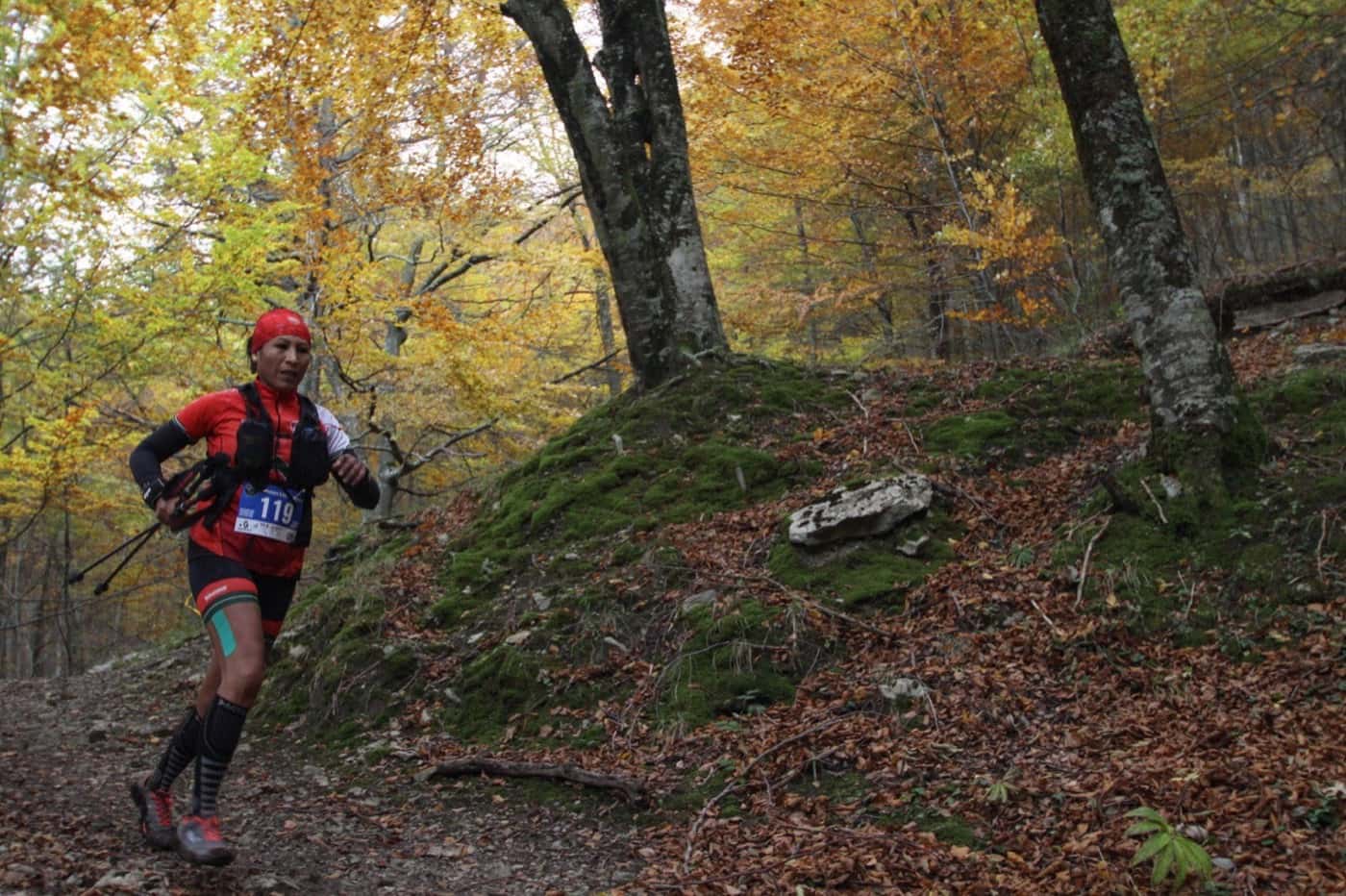
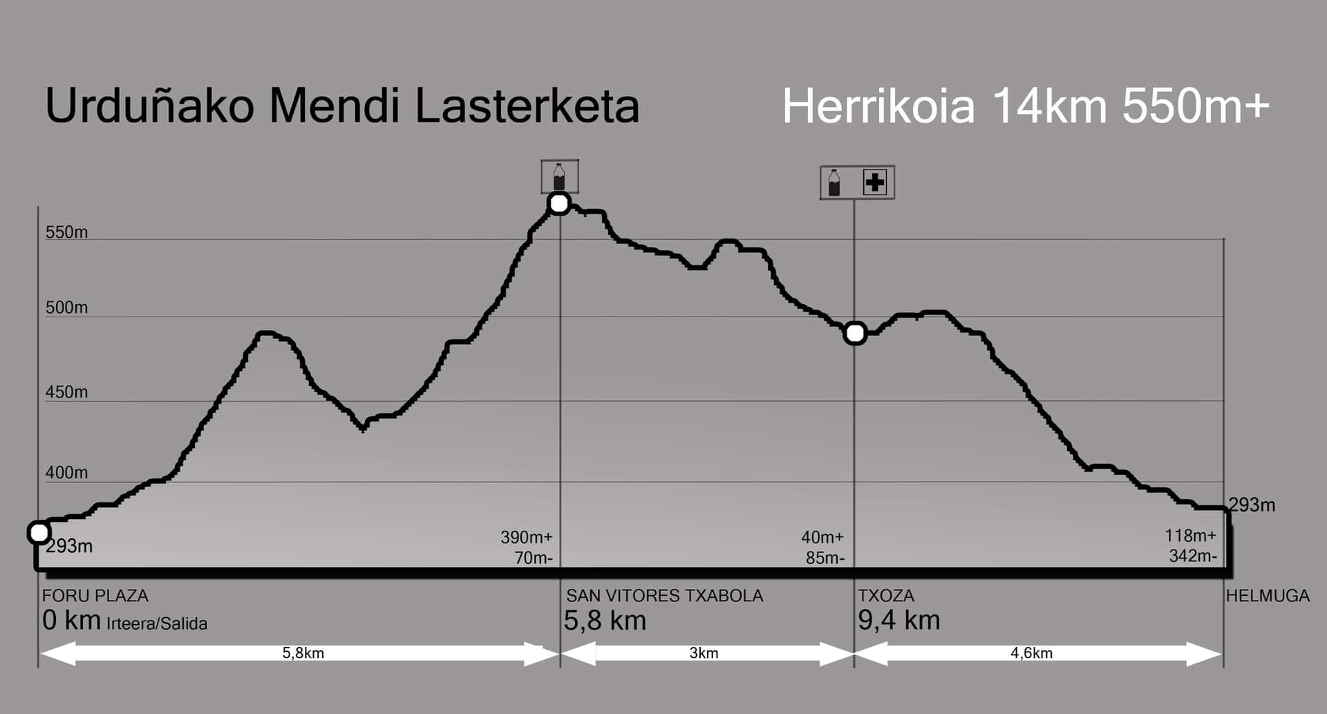
A fast 14km race with 550m+ of elevation gain, ideal for any trail lover. Starting and finishing at Foru Plaza, the route runs through trails and forests with an aid station at km 8.5.
From there, the Valley of the Kites leads back to Orduña with spectacular views of the mountain range.
560m
293m
550m+
550m-
Start from the old town of Orduña
Start from the old town of Orduña
Route through trails and forests
Route through trails and forests
Aid station at km 8.5
Aid station at km 8.5
Finish in the heart of Orduña
Finish in the heart of Orduña
Interactive route · Drag to explore · Zoom for details
Eskerrik asko. Se ha notado el mimo con el que la organizáis. Da gusto coronar uno de esos repechos infernales y tener gente tan animada dándolo todo. El toque de la alboka brutal. Lo dicho, entorno espectacular y organización de 10. Seguro que el año que viene repito.

Aitor Quintanilla
Corredor
Ayuntamiento de Orduña

Monumento Natural Monte Santiago
Red de Áreas Protegidas de Castilla y León

Junta de Castilla y León

Gualdetxu MBTT

Lacturale

Apartamentos Ciudad de Orduña

Crown